2010
SN1951 : Scale of the cliffs at Mwnt
taken 14 years ago, 3 km from Y Ferwig, Ceredigion/Sir Ceredigion, Wales
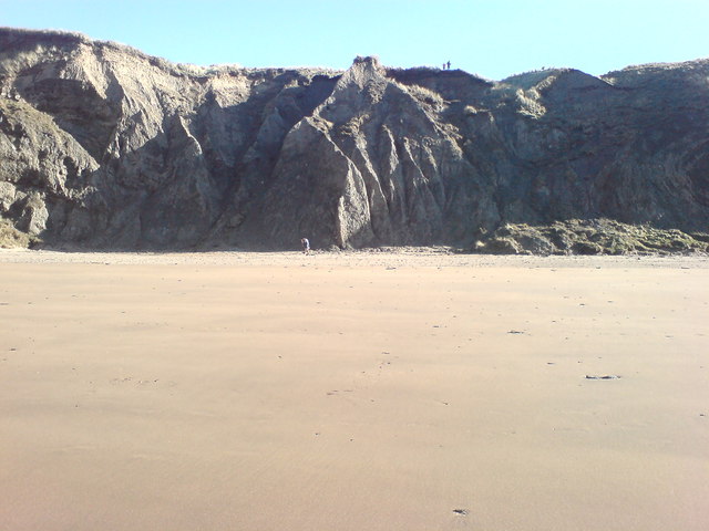
Scale of the cliffs at Mwnt
The people on the clifftop are easily visible. The man at the base not so. If I had wanted to get closer for the shot you would have seen him brandishing a 4' axe and demolishing a piece of wood! He alternated this act with charging up and down the steep cliffpath steps and repeating the action on a piece of wood at the top!
I'm sure it was some bizarre exercise routine but we didn't linger a great deal longer and others on the beach gave him a respectful distance!
I'm sure it was some bizarre exercise routine but we didn't linger a great deal longer and others on the beach gave him a respectful distance!
 Map © Crown Copyright")
TIP: Click the map for more Large scale mapping
- Grid Square
- SN1951, 100 images (more nearby 🔍)
- Photographer
- Deborah Tilley (more nearby)
- Date Taken
- Sunday, 14 February, 2010 (more nearby)
- Submitted
- Sunday, 28 February, 2010
- Subject Location
-
OSGB36:
 SN 193 519 [100m precision]
WGS84: 52:8.1478N 4:38.4340W - Camera Location
-
OSGB36: SN 193 519
- View Direction
- EAST (about 90 degrees)