2010
SD6817 : The line of the disused tramway from near the former mine
taken 14 years ago, near to Belmont, Blackburn With Darwen, England
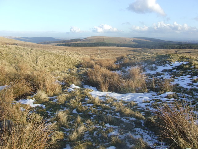
The line of the disused tramway from near the former mine
The line of this tramway runs straight across the moor and can be seen in the distance in the centre of the photograph. It joined the mine to a Sanitary Pipe factory which was located on the site of the woods. The ruins of Cooper's farm can be seen on the left of this photograph.
 Map © Crown Copyright")
TIP: Click the map for more Large scale mapping
- Grid Square
- SD6817, 21 images (more nearby 🔍)
- Photographer
- Andrew Gritt (more nearby)
- Date Taken
- Monday, 1 March, 2010 (more nearby)
- Submitted
- Tuesday, 2 March, 2010
- Subject Location
-
OSGB36:
 SD 6875 1765 [10m precision]
WGS84: 53:39.2643N 2:28.4576W - Camera Location
-
OSGB36: SD 6870 1767
- View Direction
- East-southeast (about 112 degrees)