2005
SJ7005 : Burtondale Flats
taken 18 years ago, near to Stirchley, Telford And Wrekin, England
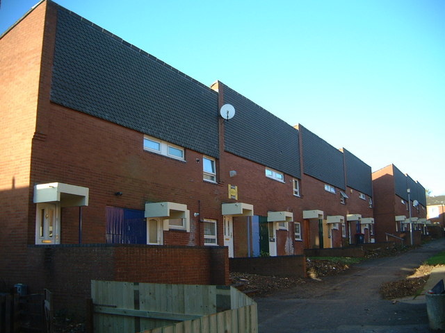
Burtondale Flats
Picturesque 60s/70s council housing in Brookside. The path continues on up toward Brookside Shops.
 Map © Crown Copyright")
TIP: Click the map for more Large scale mapping
- Grid Square
- SJ7005, 19 images (more nearby 🔍)
- Photographer
- Steve McShane (more nearby)
- Date Taken
- Saturday, 12 November, 2005 (more nearby)
- Submitted
- Monday, 22 May, 2006
- Subject Location
-
OSGB36:
 SJ 701 057 [100m precision]
WGS84: 52:38.8922N 2:26.6024W - View Direction
- North-northwest (about 337 degrees)