J3373 : Bruce Street (western end), Belfast
taken 14 years ago, near to Belfast, Co Antrim, Northern Ireland
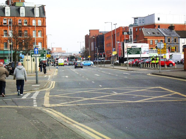
Bruce Street (western end), Belfast
Taken from the corner of St. Andrew's Square on Hope Street. In the early 1980s the buildings that would have stood in the centre of this image were cleared to make way for this inner-city arterial route linking Sandy Row with the Dublin Road. The original course of Hope Street is visible in the image (veering to left) and on Google Maps Satellite imagery. Bruce Street, back then, only existed further west - a narrow side street off the Dublin Road - see J3373 : Bruce Street, Belfast (2).
![Creative Commons Licence [Some Rights Reserved]](https://s1.geograph.org.uk/img/somerights20.gif)
|
· Find out How to reuse this image ·
Share:
|
|||||
|
There are 2 posts in a
discussion on J3373 (preview on the left) |
Suggest an update to this image | Contact the contributor | |||
Loading map... (JavaScript required)
- Grid Square
- J3373, 2776 images (more nearby
 )
)
- Photographer
- Dean Molyneaux (find more nearby)
- Date Taken
- Wednesday, 3 March, 2010 (more nearby)
- Submitted
- Thursday, 4 March, 2010
- Category
- Road > Road (more nearby)
- Subject Location
-
Irish:
 J 335 736 [100m precision]
WGS84: 54:35.5955N 5:56.0488W - Camera Location
-
Irish: J 334 736
- View Direction
- East-southeast (about 112 degrees)
Image classification(about):
Geograph
This page has been viewed about 82 times.
View this location:
KML (Google Earth) ·
Google Maps ·
Bing Maps ·
Geograph Coverage Map ·
More Links for this image
·
Bing Maps ·
Geograph Coverage Map ·
More Links for this image