2010
SZ0891 : Bournemouth: St. Stephens Road dug up
taken 14 years ago, near to Bournemouth, Bournemouth, Christchurch & Poole, England
This is 1 of 7 images, with title starting with Bournemouth: St. Stephenâs in this square
Bournemouth: St. Stephens Road dug up
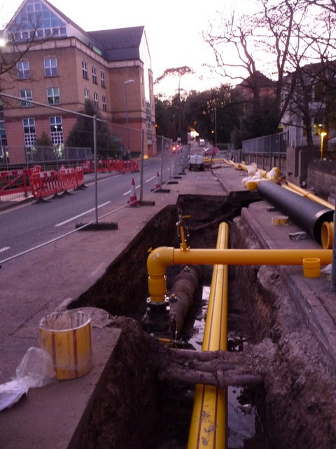
Looking west along St. Stephen's Road, with the SZ0891 : Bournemouth: gas main works in St. Stephens Road taking place on the SZ0891 : Bournemouth: bridge over Braidley Road. See also SZ0891 : Bournemouth: gas works continue in St. Stephens Road for more commentary.
On the left is the rear entrance the public enquiry office of the Town Hall, actually the early-1990s extension put on to the back of the Victorian main Town Hall.
On the left is the rear entrance the public enquiry office of the Town Hall, actually the early-1990s extension put on to the back of the Victorian main Town Hall.
 Map © Crown Copyright")
TIP: Click the map for more Large scale mapping
- Grid Square
- SZ0891, 1884 images (more nearby 🔍)
- Photographer
- Chris Downer (more nearby)
- Date Taken
- Friday, 5 March, 2010 (more nearby)
- Submitted
- Friday, 5 March, 2010
- Subject Location
-
OSGB36:
 SZ 084 914 [100m precision]
WGS84: 50:43.3784N 1:52.8909W - Camera Location
-
OSGB36: SZ 084 914
- View Direction
- WEST (about 270 degrees)