2010
NM5921 : Rubha na Faoilinn
taken 14 years ago, 4 km SSW of Lochbuie, Isle of Mull, Argyll And Bute, Scotland
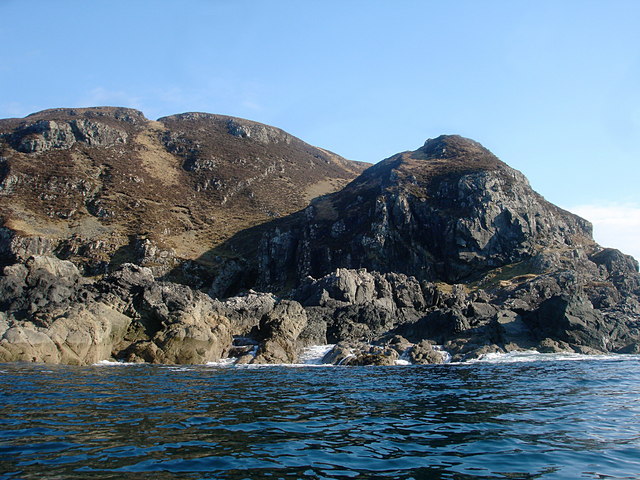
Rubha na Faoilinn
Rubha na Faoilinn is the headland at the southeast side of the entrance to Loch Buie, and is exposed to swell even on a very calm day such as the one seen here. The ridge behind the wave-cut platform rises to 301m at Cnoc a'Ghille, though the skyline seen in the picture is nearer and lower.
 Map © Crown Copyright")
TIP: Click the map for more Large scale mapping
- Grid Square
- NM5921 (more nearby 🔍)
- Photographer
- Andy Waddington (more nearby)
- Date Taken
- Tuesday, 9 March, 2010 (more nearby)
- Submitted
- Sunday, 14 March, 2010
- Subject Location
-
OSGB36:
 NM 5979 2122 [10m precision]
WGS84: 56:19.3370N 5:53.1909W - Camera Location
-
OSGB36: NM 5968 2127
- View Direction
- East-southeast (about 112 degrees)