2010
NY9300 : Sir Francis Level
taken 14 years ago, near to Ivelet, North Yorkshire, England
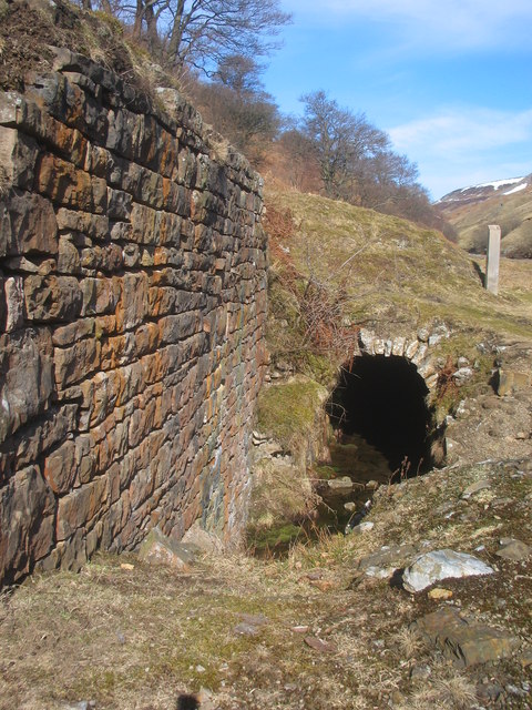
Sir Francis Level
Driven around 1km towards the head of the valley to de-water the lead mines.
 Map © Crown Copyright")
TIP: Click the map for more Large scale mapping
- Grid Square
- NY9300, 23 images (more nearby 🔍)
- Photographer
- Chris Twigg (more nearby)
- Date Taken
- Wednesday, 10 March, 2010 (more nearby)
- Submitted
- Sunday, 14 March, 2010
- Subject Location
-
OSGB36:
 NY 939 000 [100m precision]
WGS84: 54:23.7425N 2:5.6627W - Camera Location
-
OSGB36: SD 939 999
- View Direction
- NORTH (about 0 degrees)