N7049 : Donore Castle, County Meath
taken 16 years ago, 4 km NNW of Longwood, Co Meath, Ireland
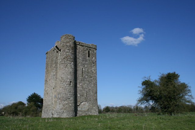
Donore Castle, County Meath
Circa 1492 - this tower house was the residence of a wealthy landowner. The natives were not friendly. If I've got my grid square right the River Boyne flows just behind the castle.
![Creative Commons Licence [Some Rights Reserved]](https://s1.geograph.org.uk/img/somerights20.gif)
|
· Find out How to reuse this image ·
Share:
|
|||||
| Start a discussion on N7049 | Suggest an update to this image | Contact the contributor | |||
Loading map... (JavaScript required)
- Grid Square
- N7049, 3 images (more nearby
 )
)
- Photographer
- Sarah777 (find more nearby)
- Date Taken
- Wednesday, 16 April, 2008 (more nearby)
- Submitted
- Saturday, 10 April, 2010
- Category
- Tower house (more nearby)
- Subject Location
-
Irish:
 N 705 497 [100m precision]
WGS84: 53:29.5787N 6:56.3029W - Camera Location
-
Irish: N 705 497
- View Direction
- South-southwest (about 202 degrees)
This page has been viewed about 203 times.
View this location:
KML (Google Earth) ·
Google Maps ·
Bing Maps ·
Geograph Coverage Map ·
More Links for this image
·
Bing Maps ·
Geograph Coverage Map ·
More Links for this image