2006
ST8153 : Field of crop and new housing at Rode, Wiltshire
taken 18 years ago, near to Rode, Somerset, England
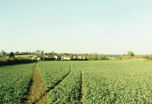
Field of crop and new housing at Rode, Wiltshire
A view looking north across the field to the new development by the junction of the A361 and the B3109 just to the west of Parsonage Farm which is hidden in the fold of the hill on the very right hand edge of the photo.
 Map © Crown Copyright")
TIP: Click the map for more Large scale mapping
- Grid Square
- ST8153, 8 images (more nearby 🔍)
- Photographer
- Alan Cooper (more nearby)
- Date Taken
- Sunday, 19 March, 2006 (more nearby)
- Submitted
- Sunday, 4 June, 2006
- Subject Location
-
OSGB36:
 ST 810 537 [100m precision]
WGS84: 51:16.9272N 2:16.4283W - Camera Location
-
OSGB36: ST 811 534
- View Direction
- NORTH (about 0 degrees)