TQ0734 : Milepost, Downs Link, Sussex - Surrey Border
taken 14 years ago, near to Rudgwick, West Sussex, England
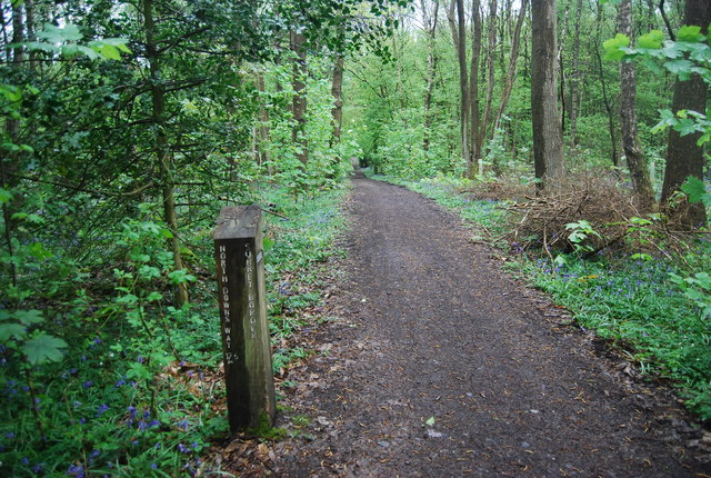
The Downs Link is a 37-mile (59 km) footpath and bridleway linking the North Downs Way Link at St. Martha's Hill in Surrey with the South Downs Way Link near Steyning in West Sussex and on via the Coastal Link to Shoreham-by-Sea. Most of the route follows two dismantled railway lines, both closed by the Beeching cuts in the 1960s. The Shoreham-On-Sea to Christs Hospital line and the Christs Hospital to Shalford Junction line. The link opened in 1984.
Cycle Route 223 follows the Downs link from Guildford to Shoreham.
The logo for the walk is the viaduct across the River Arun TQ0932 : Double Viaduct over the River Arun.
A full history of the Cranleigh line (Christs Hospital to Shalford Junction) can be read at Link
A milestone is one of a series of numbered markers placed along a road, canal, railway or sometimes paths at intervals of one mile or occasionally, parts of a mile. They are typically located at the side of the route. They are alternatively known as mileposts or mile posts (abbreviated MP on maps). Mileage is the distance along the route from a fixed starting point.
Milestones are constructed to provide reference points along the route. This can be used to reassure travellers that the correct route is being followed, and to indicate either distance travelled or the remaining distance to a destination.
Wikipedia: Link
 Map © Crown Copyright")
- Grid Square
- TQ0734, 55 images (more nearby 🔍)
- Photographer
- N Chadwick (more nearby)
- Date Taken
- Sunday, 2 May, 2010 (more nearby)
- Submitted
- Monday, 24 May, 2010
- Subject Location
-
OSGB36:
 TQ 079 344 [100m precision]
WGS84: 51:5.9687N 0:27.6059W - Camera Location
-
OSGB36: TQ 079 344
- View Direction
- NORTH (about 0 degrees)