2010
NX4838 : Cairnhead Bay
taken 14 years ago, near to Isle of Whithorn, Dumfries And Galloway, Scotland
This is 1 of 5 images, with title Cairnhead Bay in this square
Cairnhead Bay
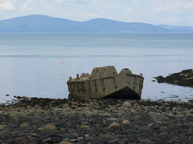
This 'beetle' is one of the last remaining examples of the reinforced concrete pontoons used to carry floating roadways as part of the Mulberry Harbour Project Construction Yard based at Cairnhead. Link Link. It is clearly visible on Google Satellite Mapping but can only usually be seen in full at low tide. Aside from a couple of holes it's in pretty good condition having rested here since WW2
 Map © Crown Copyright")
TIP: Click the map for more Large scale mapping
- Grid Square
- NX4838, 46 images (more nearby 🔍)
- Photographer
- Andy Farrington (more nearby)
- Date Taken
- Monday, 24 May, 2010 (more nearby)
- Submitted
- Tuesday, 25 May, 2010
- Subject Location
-
OSGB36:
 NX 483 383 [100m precision]
WGS84: 54:43.0055N 4:21.3954W - Camera Location
-
OSGB36: NX 483 383
- View Direction
- East-northeast (about 67 degrees)