2006
ST6877 : Chimney of the disused Brandy Bottom Colliery
taken 18 years ago, near to Pucklechurch, South Gloucestershire, England
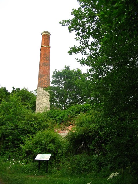
Chimney of the disused Brandy Bottom Colliery
Photograph taken from the Bristol to Bath Railway Path.
Owned by Lord Radnor, the colliery was opened in the early 19th century and closed in 1936.
The chimney and engine house are still intact, the site is an English Heritage scheduled monument.
Owned by Lord Radnor, the colliery was opened in the early 19th century and closed in 1936.
The chimney and engine house are still intact, the site is an English Heritage scheduled monument.
 Map © Crown Copyright")
TIP: Click the map for more Large scale mapping
- Grid Square
- ST6877, 77 images (more nearby 🔍)
- Photographer
- Duncan Gammon (more nearby)
- Date Taken
- Friday, 23 June, 2006 (more nearby)
- Submitted
- Saturday, 24 June, 2006
- Subject Location
-
OSGB36:
 ST 6818 7713 [10m precision]
WGS84: 51:29.5327N 2:27.5831W - View Direction
- East-northeast (about 67 degrees)