W0165 : Lough Akinkeen and surrounding track and forestry system
taken 14 years ago, 8 km ENE of Bunane, Co Kerry, Ireland
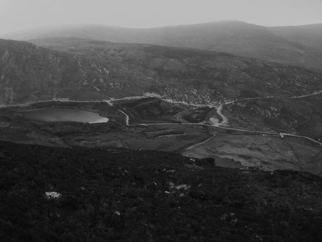
Lough Akinkeen and surrounding track and forestry system
In my opinion this is an example of a poor land use policy, a previously pristine corrie and lake area has been "developed".
Aside from the obvious visual vandalism the forestry plantation is ridiculously small and uneconomic although the higher track (not shown on my 2000 OS map) seems to indicate that there are ambitions to develop this venture further.
Aside from the obvious visual vandalism the forestry plantation is ridiculously small and uneconomic although the higher track (not shown on my 2000 OS map) seems to indicate that there are ambitions to develop this venture further.
![Creative Commons Licence [Some Rights Reserved]](https://s1.geograph.org.uk/img/somerights20.gif)
|
· Find out How to reuse this image ·
Share:
|
|||||
| Start a discussion on W0165 | Suggest an update to this image | Contact the contributor | |||
Loading map... (JavaScript required)
- Grid Square
- W0165 (more nearby
 )
)
- Photographer
- Keith Cunneen (find more nearby)
- Date Taken
- Thursday, 10 June, 2010 (more nearby)
- Submitted
- Tuesday, 15 June, 2010
- Category
- Lough (more nearby)
- Subject Location
-
Irish:
 W 015 652 [100m precision]
WGS84: 51:49.8547N 9:25.7737W - Camera Location
-
Irish: W 024 649
- View Direction
- West-northwest (about 292 degrees)
Image classification(about):
Supplemental image
This page has been viewed about 93 times.
View this location:
KML (Google Earth) ·
Google Maps ·
Bing Maps ·
Geograph Coverage Map ·
More Links for this image
·
Bing Maps ·
Geograph Coverage Map ·
More Links for this image