2005
SE9443 : The Hudson Way
taken 19 years ago, 3 km from South Dalton, East Riding of Yorkshire, England
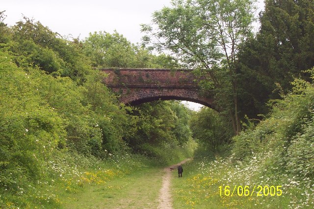
The Hudson Way
Walking eastwards from Kiplingcoates towards Etton. Great orchid-spotting territory in June. The Hudson Way follows the site of a railway axed in the 1965 Beeching cuts.
 Map © Crown Copyright")
TIP: Click the map for more Large scale mapping
- Grid Square
- SE9443, 42 images (more nearby 🔍)
- Photographer
- Carolyn Metcalf (more nearby)
- Date Taken
- Thursday, 16 June, 2005 (more nearby)
- Submitted
- Thursday, 16 June, 2005
- Subject Location
-
OSGB36:
 SE 94 43 [1000m precision]
WGS84: 53:52.7459N 0:33.8392W