2006
TL0689 : Oundle School Rifle Range
taken 18 years ago, near to Ashton, North Northamptonshire, England
This is 1 of 3 images, with title Oundle School Rifle Range in this square
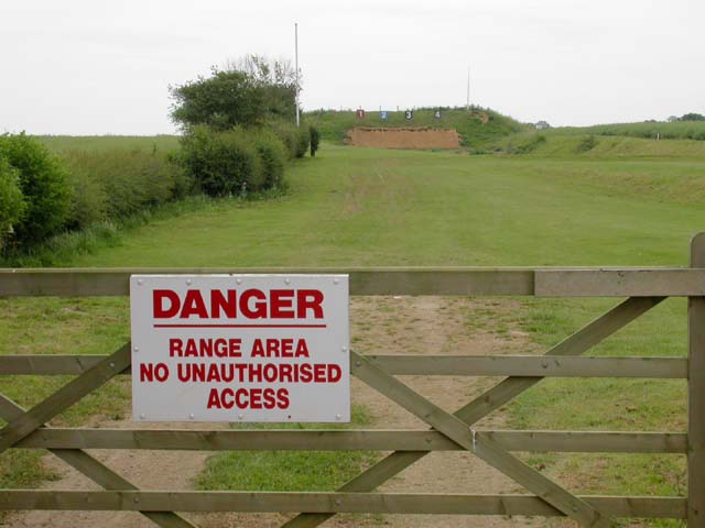
Oundle School Rifle Range
Seen from the Nene Way. There is another rifle range nearby to the west, on the other side of the path.
 Map © Crown Copyright")
TIP: Click the map for more Large scale mapping
- Grid Square
- TL0689, 18 images (more nearby 🔍)
- Photographer
- Kokai (more nearby)
- Date Taken
- Sunday, 18 June, 2006 (more nearby)
- Submitted
- Monday, 26 June, 2006
- Subject Location
-
OSGB36:
 TL 065 890 [100m precision]
WGS84: 52:29.3118N 0:25.9775W - Camera Location
-
OSGB36: TL 06532 89088
- View Direction
- EAST (about 90 degrees)