TL4493 : Large Ditch at Stonea Camp
taken 14 years ago, 4 km ENE of Wimblington, Cambridgeshire, England
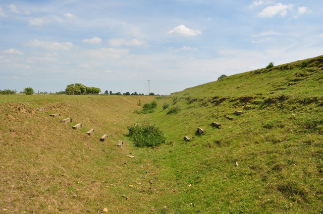
There are many information boards around the site to explain various features. They are rather big defences but would have been a lot bigger when they were built (by hand).
Stonea Camp is a scheduled ancient monument on a small gravel island just two metres above sea level, making it the lowest hillfort in the UK. The camp was surrounded by marshes on all sides apart from a land bridge which was heavily guarded. This created two D shape enclosures protecting the inhabitants. There are thought to be three phrases of construction since works started in 500BC. Some of the outer gates were never completed. Tacitus (Link
describes a battle between the Roman governor, Ostorius and the Iceni in 47AD this may have happened here. The remains of a multi-storey Roman tower have also been excavated within sight to the north of the Stonea Camp fortifications. The building was probably constructed to suppress further tribal rebellion or settlement at this site.
The defending Britons were trapped by their own defences and slaughtered like cattle. The remains of a skull belonging to a four year old child was found, badly hacked by sword cuts. Also excavated was a horribly mutilated adult skeleton; the scenes of horror. Access today is via a bumpy farm track signposted from the B1093. It is well interpreted with information boards. The embankments which are lower than they would have been were mostly rebuilt in 1991 following ploughing over the years. The site is very large and takes at least 30 minutes to look around.
 Map © Crown Copyright")
- Grid Square
- TL4493, 39 images (more nearby 🔍)
- Photographer
- Ashley Dace (more nearby)
- Date Taken
- Wednesday, 23 June, 2010 (more nearby)
- Submitted
- Thursday, 24 June, 2010
- Subject Location
-
OSGB36:
 TL 447 932 [100m precision]
WGS84: 52:31.0904N 0:7.9468E - Camera Location
-
OSGB36: TL 448 932
- View Direction
- West-northwest (about 292 degrees)