O1415 : Moorland between the R115 and Lough Bray Upper
taken 22 years ago, 3 km from Glencree, Co Wicklow, Ireland
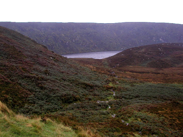
Moorland between the R115 and Lough Bray Upper
Taken from the car park (at O143152) on the R115 looking due west.
![Creative Commons Licence [Some Rights Reserved]](https://s1.geograph.org.uk/img/somerights20.gif)
|
· Find out How to reuse this image ·
Share:
|
|||||
| Start a discussion on O1415 | Suggest an update to this image | Contact the contributor | |||
Loading map... (JavaScript required)
- Grid Square
- O1415, 6 images (more nearby
 )
)
- Photographer
- Andy Beecroft (find more nearby)
- Date Taken
- Wednesday, 16 October, 2002 (more nearby)
- Submitted
- Saturday, 18 June, 2005
- Category
- Lakes and Rivers (more nearby)
- Subject Location
-
Irish:
 O 14 15 [1000m precision]
WGS84: 53:10.6755N 6:17.2929W
This page has been viewed about 194 times.
View this location:
KML (Google Earth) ·
Google Maps ·
Bing Maps ·
Geograph Coverage Map ·
More Links for this image
·
Bing Maps ·
Geograph Coverage Map ·
More Links for this image