N8056 : Moat and water gate at Trim Castle
taken 14 years ago, near to Trim, Co Meath, Ireland
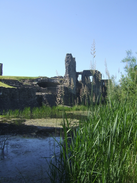
Moat and water gate at Trim Castle
Trim is the largest Anglo-Norman castle in Ireland. It is located at a strategic crossing point on the River Boyne and marks the edge of 'The Pale'.
![Creative Commons Licence [Some Rights Reserved]](https://s1.geograph.org.uk/img/somerights20.gif)
|
· Find out How to reuse this image ·
Share:
|
|||||
| Start a discussion on N8056 | Suggest an update to this image | Contact the contributor | |||
Loading map... (JavaScript required)
- Grid Square
- N8056, 128 images (more nearby
 )
)
- Photographer
- John M (find more nearby)
- Date Taken
- Sunday, 20 June, 2010 (more nearby)
- Submitted
- Monday, 26 July, 2010
- Category
- Moat (more nearby)
- Subject Location
-
Irish:
 N 803 568 [100m precision]
WGS84: 53:33.3212N 6:47.3456W - Camera Location
-
Irish: N 803 568
- View Direction
- West-southwest (about 247 degrees)
Image classification(about):
Geograph
This page has been viewed about 205 times.
View this location:
KML (Google Earth) ·
Google Maps ·
Bing Maps ·
Geograph Coverage Map ·
More Links for this image
·
Bing Maps ·
Geograph Coverage Map ·
More Links for this image