2010
SC3472 : The Anchor Pub
taken 14 years ago, near to Quine's Hill, Isle of Man
This is 1 of 2 images, with title starting with The Anchor in this square
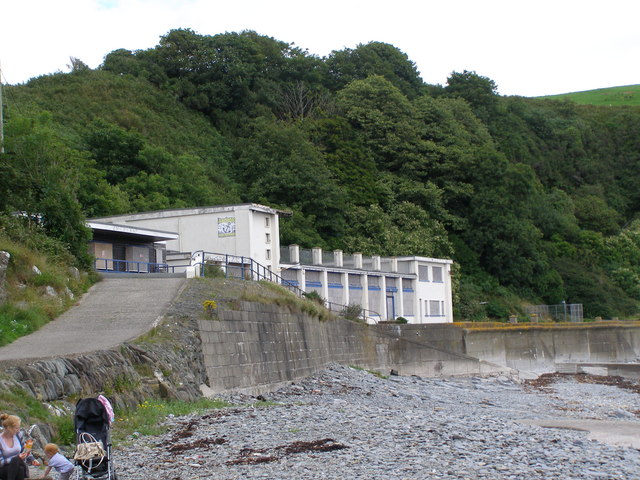
The Anchor Pub
The disused Anchor Pub at Port Soderick taken from in front of the onetime Amusement Arcade.
 Map © Crown Copyright")
TIP: Click the map for more Large scale mapping
- Grid Square
- SC3472, 54 images (more nearby 🔍)
- Photographer
- Anne and Jeff Rolfe (more nearby)
- Date Taken
- Tuesday, 27 July, 2010 (more nearby)
- Submitted
- Wednesday, 28 July, 2010
- Subject Location
-
OSGB36:
 SC 34682 72670 [1m precision]
WGS84: 54:7.3940N 4:31.8711W - Camera Location
-
OSGB36: SC 34667 72577
- View Direction
- NORTH (about 0 degrees)