2006
NO2582 : Allt an Dubh Loch
taken 18 years ago, near to Glas-Allt-Shiel, Aberdeenshire, Scotland
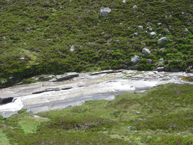
Allt an Dubh Loch
This unusual flat slab forms part of the watercourse of Allt an Dubh Loch, the stream (burn) that runs from the Dubh Loch to Loch Muick. It is one of several such slabs in the area where the strata seem to lie naturally at the correct angle for the water to flow smoothly.
 Map © Crown Copyright")
TIP: Click the map for more Large scale mapping
- Grid Square
- NO2582, 7 images (more nearby 🔍)
- Photographer
- Iain Millar (more nearby)
- Date Taken
- Saturday, 8 July, 2006 (more nearby)
- Submitted
- Tuesday, 11 July, 2006
- Subject Location
-
OSGB36:
 NO 253 820 [100m precision]
WGS84: 56:55.3953N 3:13.7264W - Camera Location
-
OSGB36: NO 253 822
- View Direction
- SOUTH (about 180 degrees)