2010
SJ8194 : Old playing fields
taken 14 years ago, near to Chorlton-Cum-Hardy, Manchester, England
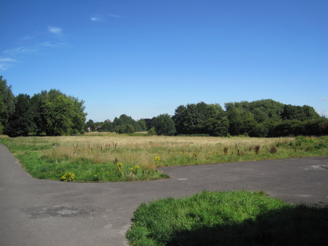
Old playing fields
At the end of Rye Bank Road are these old playing fields. They area fairly overgrown and well used by dog walkers. In the past few years there were plans to build on this area, however they were overturned by a local protest group.
 Map © Crown Copyright")
TIP: Click the map for more Large scale mapping
- Grid Square
- SJ8194, 80 images (more nearby 🔍)
- Photographer
- Paddy Griffin (more nearby)
- Date Taken
- Monday, 16 August, 2010 (more nearby)
- Submitted
- Friday, 20 August, 2010
- Subject Location
-
OSGB36:
 SJ 810 945 [100m precision]
WGS84: 53:26.8153N 2:17.1800W - Camera Location
-
OSGB36: SJ 810 944
- View Direction
- Northeast (about 45 degrees)