2010
TF9627 : The ruins of All Saints' church in Little Ryburgh
taken 14 years ago, near to Little Ryburgh, Norfolk, England
This is 1 of 3 images, with title The ruins of All Saints' church in Little Ryburgh in this square
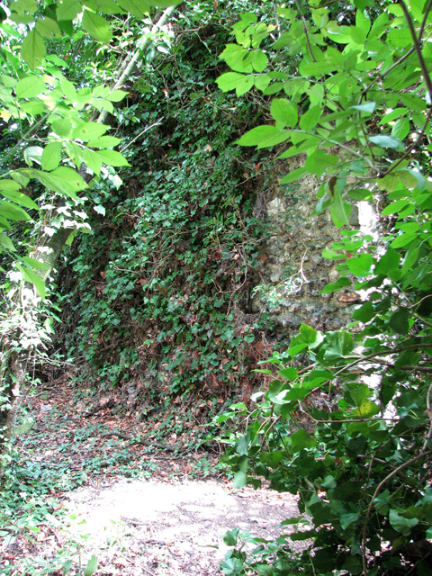
The ruins of All Saints' church in Little Ryburgh
The new parish cemetery of Great Ryburgh is situated at Cley Hill, about 800 metres to the north-east of St Andrew's church > Link in the village centre, on the other side of the River Wensum. Hidden in the copse that adjoins the graveyard in the north > Link lie the remains of All Saints', the former parish church of the hamlet of Little Ryburgh. The church never had a tower and its earliest parts date from the 11th century. Much of the nave west wall and some sections of the south wall are still standing, albeit much overgrown and almost impossible to photograph. The church was abandoned in 1750 when the parishes of Great and Little Ryburgh were consolidated and the latter ceased to exist.
 Map © Crown Copyright")
TIP: Click the map for more Large scale mapping
- Grid Square
- TF9627, 57 images (more nearby 🔍)
- Photographer
- Evelyn Simak (more nearby)
- Date Taken
- Tuesday, 24 August, 2010 (more nearby)
- Submitted
- Wednesday, 25 August, 2010
- Subject Location
-
OSGB36:
 TF 968 276 [100m precision]
WGS84: 52:48.6440N 0:55.1303E - Camera Location
-
OSGB36: TF 967 276
- View Direction
- Northeast (about 45 degrees)