2010
NT9220 : Harthope Burn flood damage (2)
taken 14 years ago, 3 km from Langleeford, Northumberland, England
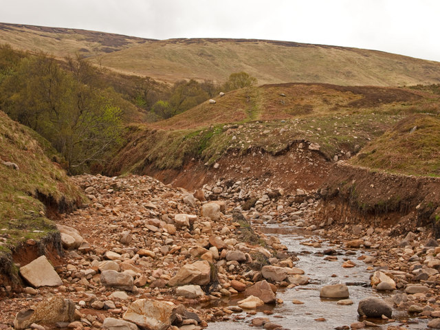
Harthope Burn flood damage (2)
This is the point where the flood waters from Cheviot ran into the burn from the right of the image.
 Map © Crown Copyright")
TIP: Click the map for more Large scale mapping
- Grid Square
- NT9220, 37 images (more nearby 🔍)
- Photographer
- Kenneth Ross (more nearby)
- Date Taken
- Sunday, 9 May, 2010 (more nearby)
- Submitted
- Saturday, 28 August, 2010
- Subject Location
-
OSGB36:
 NT 928 203 [100m precision]
WGS84: 55:28.6095N 2:6.9277W - Camera Location
-
OSGB36: NT 928 204
- View Direction
- SOUTH (about 180 degrees)