J3683 : The Loughshore Park, Jordanstown (4)
taken 14 years ago, near to Whiteabbey, Co Antrim, Northern Ireland
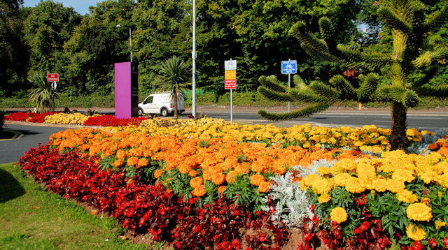
The Loughshore Park, Jordanstown (4)
One of the flowerbeds between the park and the Shore Road.
The Loughshore Park, Jordanstown
The Loughshore Park, Jordanstown lies between the Shore Road and Belfast Lough. It includes a coastal path. It is due to close soon for a £1.34 million upgrading of facilities at the Park and the surrounding area starts . . . . The project will include the replacement of the existing amenity block and toilets with modern facilities for caravanners . . . . . including, for the first time, a café. There will also be an expansion of the caravan site, a new bandstand, the construction of a stepped terrace to provide access to the shore, improvements to the layout of the car park and new street furniture and signage and a major piece of public art.
![Creative Commons Licence [Some Rights Reserved]](https://s1.geograph.org.uk/img/somerights20.gif)
|
· Find out How to reuse this image ·
Share:
|
|||||
| Start a discussion on J3683 | Suggest an update to this image | Contact the contributor | |||
Loading map... (JavaScript required)
- Grid Square
- J3683, 80 images (more nearby
 )
)
- Photographer
- Albert Bridge (find more nearby)
- Date Taken
- Thursday, 2 September, 2010 (more nearby)
- Submitted
- Thursday, 2 September, 2010
- Category
- Flowerbeds (more nearby)
- Subject Location
-
Irish:
 J 365 835 [100m precision]
WGS84: 54:40.8965N 5:53.0257W - Camera Location
-
Irish: J 365 835
- View Direction
- West-southwest (about 247 degrees)
Image classification(about):
Supplemental image
This page has been viewed about 77 times.
View this location:
KML (Google Earth) ·
Google Maps ·
Bing Maps ·
Geograph Coverage Map ·
More Links for this image
·
Bing Maps ·
Geograph Coverage Map ·
More Links for this image