J3471 : Dredging the River Lagan, Belfast - 2010/11 (25)
taken 14 years ago, 3 km from Belfast, Co Antrim, Northern Ireland
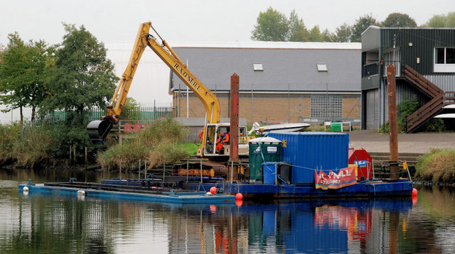
Work is about to start on the dredging of the River Lagan downstream of the Stranmillis weir. According to an official statement The £2.8m contract, awarded to local firm Graham Construction, will see dredging on the river for the first time since 1994 . . . It will start mid-September and is due to finish spring 2011. The work involves thousands of tonnes of silt being removed by diggers and disposed off at an approved location out at sea. The river will be initially closed to navigation for safety reasons during the period of the contract. However, after consultation with river users the works will be completed on a sectional basis with the first section being handed over to river users after six weeks. The last dredging contract was in 2002 J3474 : Dredging barges, River Lagan, Belfast (2).
![Creative Commons Licence [Some Rights Reserved]](https://s1.geograph.org.uk/img/somerights20.gif)
|
· Find out How to reuse this image ·
Share:
|
|||||
| Start a discussion on J3471 | Suggest an update to this image | Contact the contributor | |||
- Grid Square
- J3471, 273 images (more nearby
 )
)
- Photographer
- Albert Bridge (find more nearby)
- Date Taken
- Thursday, 14 October, 2010 (more nearby)
- Submitted
- Thursday, 14 October, 2010
- Category
- Dredging (more nearby)
- Subject Location
-
Irish:
 J 342 710 [100m precision]
WGS84: 54:34.2066N 5:55.5346W - Camera Location
-
Irish: J 341 712
- View Direction
- South-southeast (about 157 degrees)