J2627 : Spelga Dam from Slievenamuck
taken 13 years ago, 6 km ESE of Hilltown, Co Down, Northern Ireland
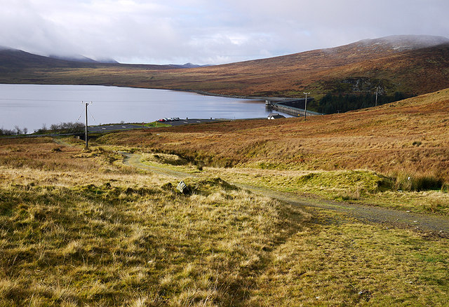
Spelga Dam from Slievenamuck
A view down towards Spelga Dam from the ascent up Slievenamuck.
Spelga Dam
Spelga Dam is a reservoir in the Mourne Mountains. It was constructed 1953-1957 and supplies water to parts of Counties Armagh and Down. Together with nearby Fofanny Reservoir, it can supply 6,500,000 gallons of water per day and discharges 500,000 gallons a day back into the River Bann.
See Linkfor a video on the construction of the dam.
![Creative Commons Licence [Some Rights Reserved]](https://s1.geograph.org.uk/img/somerights20.gif)
|
· Find out How to reuse this image ·
Share:
|
|||||
| Start a discussion on J2627 | Suggest an update to this image | Contact the contributor | |||
Loading map... (JavaScript required)
- Grid Square
- J2627, 96 images (more nearby
 )
)
- Photographer
- Rossographer (find more nearby)
- Date Taken
- Saturday, 23 October, 2010 (more nearby)
- Submitted
- Monday, 25 October, 2010
- Category
- Mountainside (more nearby)
- Subject Location
-
Irish:
 J 268 274 [100m precision]
WGS84: 54:10.7958N 6:3.4835W - Camera Location
-
Irish: J 269 276
- View Direction
- South-southwest (about 202 degrees)
Image classification(about):
Geograph
This page has been viewed about 78 times.
View this location:
KML (Google Earth) ·
Google Maps ·
Bing Maps ·
Geograph Coverage Map ·
More Links for this image