2005
SX1780 : Marsh near the source of the Fowey
taken 19 years ago, 4 km NNW of Bolventor, Cornwall, England
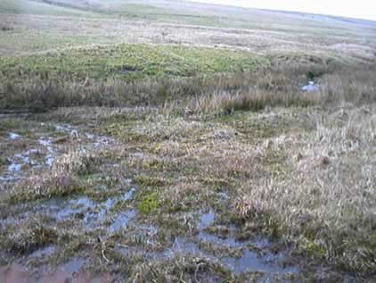
Marsh near the source of the Fowey
This is the marsh at the foot of Leskernick Hill, by the River Fowey. The walking gets dangerous here, and it's best to seek higher ground for a few km!
 Map © Crown Copyright")
TIP: Click the map for more Large scale mapping
- Grid Square
- SX1780, 3 images (more nearby 🔍)
- Photographer
- Beccy (more nearby)
- Date Taken
- Wednesday, 30 March, 2005 (more nearby)
- Submitted
- Sunday, 10 April, 2005
- Subject Location
-
OSGB36:
 SX 17 80 [1000m precision]
WGS84: 50:35.7374N 4:34.7968W