J3272 : Development site, Lisburn Road/Tate's Avenue, Belfast (1)
taken 13 years ago, near to Belfast, Co Antrim, Northern Ireland
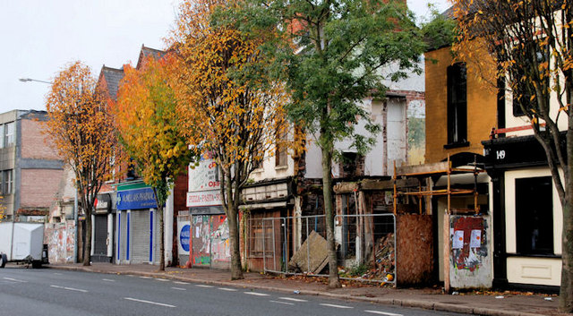
Development site, Lisburn Road/Tate's Avenue, Belfast (1)
The Lisburn Road frontage.
Development site, Lisburn Road/Tate's Avenue, Belfast
A development site, mainly fronting the Lisburn Road, for which there is planning permission as follows Z/2008/2429/F 155-177 Lisburn Road, 16 Ashley Avenue, 3-7 Tates Avenue BT9 approval 17 June 2010 Mixed use development of 45 No. Private apartments with on site car parking and 3 No. retail units to ground floor. The Belfast Gazette carried an advertisement recording the appointment of an administrator to the development company, on 27 October 2009. The site (on 31 October 2010) comprises a vacant building, derelict buildings and vacant ground. Note: this description and the photographs submitted by me appear as a matter of record only. I have no connection with the developer, the administrator or any estate agent.
![Creative Commons Licence [Some Rights Reserved]](https://s1.geograph.org.uk/img/somerights20.gif)
|
· Find out How to reuse this image ·
Share:
|
|||||
|
There is 1 post in a
discussion on J3272 (preview on the left) |
Suggest an update to this image | Contact the contributor | |||
Loading map... (JavaScript required)
- Grid Square
- J3272, 436 images (more nearby
 )
)
- Photographer
- Albert Bridge (find more nearby)
- Date Taken
- Sunday, 31 October, 2010 (more nearby)
- Submitted
- Sunday, 31 October, 2010
- Category
- Development site (more nearby)
- Subject Location
-
Irish:
 J 329 724 [100m precision]
WGS84: 54:34.9922N 5:56.7105W - Camera Location
-
Irish: J 329 725
- View Direction
- West-southwest (about 247 degrees)
Image classification(about):
Geograph
This page has been viewed about 171 times.
View this location:
KML (Google Earth) ·
Google Maps ·
Bing Maps ·
Geograph Coverage Map ·
More Links for this image
·
Bing Maps ·
Geograph Coverage Map ·
More Links for this image