2003
TR1435 : Former B2067 passing Court Farm, Pedlinge
taken 21 years ago, near to Saltwood, Kent, England
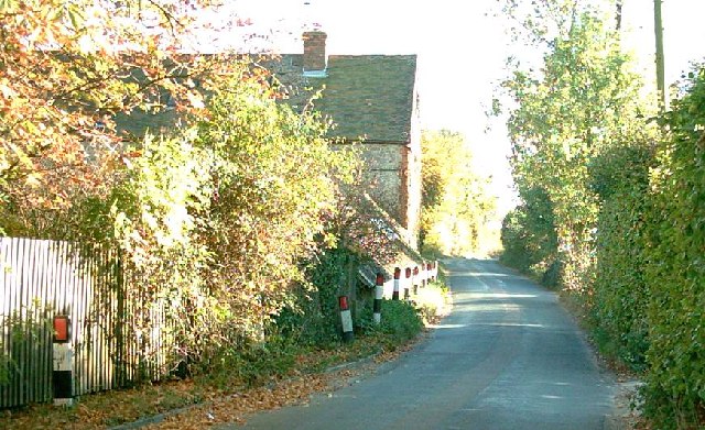
Former B2067 passing Court Farm, Pedlinge
The lane in this southward-facing shot used to be the B2067 which at this point would have rambled its way from Lympne (2 miles), Aldington (6 miles), Hamstreet (11 miles) and Tenterden (19 miles). Court Farm is on the left hand side, situated on the former cliffs to the west of Hythe. More info can be found at Link (Archive Link )
 Map © Crown Copyright")
TIP: Click the map for more Large scale mapping
- Grid Square
- TR1435, 21 images (more nearby 🔍)
- Photographer
- Adam Colton (more nearby)
- Date Taken
- October 2003 (more nearby)
- Submitted
- Saturday, 25 June, 2005
- Subject Location
-
OSGB36:
 TR 14 35 [1000m precision]
WGS84: 51:4.7227N 1:3.6541E