2001
SN5881 : Riverside Walk, Aberystwyth
taken 23 years ago, near to Aberystwyth, Ceredigion/Sir Ceredigion, Wales
This is 1 of 5 images, with title starting with Riverside Walk in this square
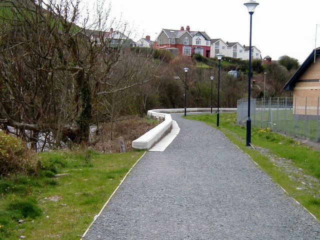
Riverside Walk, Aberystwyth
This path follows the bank of the Rheidol through the town. It is on the original route of the Vale of Rheidol Railway.
 Map © Crown Copyright")
TIP: Click the map for more Large scale mapping
- Grid Square
- SN5881, 3084 images (more nearby 🔍)
- Photographer
- John Lucas (more nearby)
- Date Taken
- Tuesday, 17 April, 2001 (more nearby)
- Submitted
- Monday, 7 August, 2006
- Subject Location
-
OSGB36:
 SN 587 811 [100m precision]
WGS84: 52:24.5762N 4:4.7246W - View Direction
- WEST (about 270 degrees)