2005
TQ9832 : The Woolpack Inn, Warehorne
taken 19 years ago, near to Warehorne, Kent, England
This is 1 of 3 images, with title The Woolpack Inn, Warehorne in this square
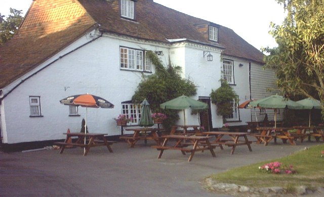
The Woolpack Inn, Warehorne
This 16th century alehouse is connected to the church of St Matthew by an underground tunnel. This was constructed by smugglers for illicit purposes. Villagers in Hamstreet tend to think of the Woolpack as their second pub - it is a short walk across the fields from the village and due to peculiar parish boundaries, part of Hamstreet village is actually in Warehorne parish.
 Map © Crown Copyright")
TIP: Click the map for more Large scale mapping
- Grid Square
- TQ9832, 96 images (more nearby 🔍)
- Photographer
- Adam Colton (more nearby)
- Date Taken
- Sunday, 26 June, 2005 (more nearby)
- Submitted
- Monday, 27 June, 2005
- Subject Location
-
OSGB36:
 TQ 9893 3255 [10m precision]
WGS84: 51:3.4694N 0:50.2381E - Camera Location
-
OSGB36: TQ 9892 3254
- View Direction
- Northeast (about 45 degrees)