SJ9199 : Cinderland Bridge
taken 53 years ago, near to Failsworth, Oldham, England
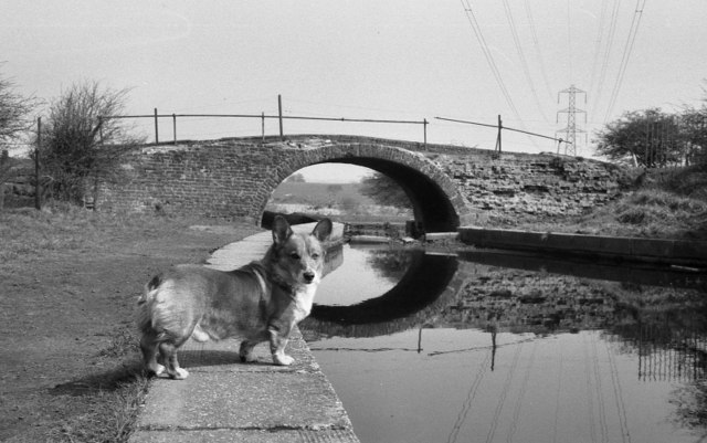
The Hollinwood Branch of the Ashton Canal was opened in 1797 to transport coal from the collieries that lay between Ashton under Lyne and Oldham to Manchester and the many mills and factories in the neighbourhood of the Ashton Canal.
Apart from mills and factories at Droylsden, The canal was comparatively rural in character. Leaving the main line of the Ashton Canal at Fairfield Junction immediately above lock 18, it ran for just over 4½ miles through Droylsden and Waterhouses to terminate at Hollinwood Basin (Hollinwood Top Wharf).
The Hollinwood Branch Canal was extensively used until the late 1920s when trade began to decline rapidly due to competition from railways and roads. It remained open and operational as far as the Butterworth Green basin until 1932, when subsidence problems caused the closure of the remaining collieries in the area and the canal was closed north of Crime Lake. Parts of the canal remained navigable but most was officially closed in 1955 with the last remaining section from the main line at Fairfield Junction closing in 1961.
The central part of the canal, in the Daisy Nook area, is still in water and has been made a feature of the Daisy Nook Country Park.
LinkPennine Waterways
 Map © Crown Copyright")
- Grid Square
- SJ9199, 73 images (more nearby 🔍)
- Photographer
- David Dixon (more nearby)
- Date Taken
- April 1971 (more nearby)
- Submitted
- Thursday, 9 December, 2010
- Subject Location
-
OSGB36:
 SJ 91159 99881 [1m precision]
WGS84: 53:29.7334N 2:8.0840W - Camera Location
-
OSGB36: SJ 911 998
- View Direction
- North-northeast (about 22 degrees)