NS3779 : Old quarry pit near Carman Hill
taken 13 years ago, near to Alexandria, West Dunbartonshire, Scotland
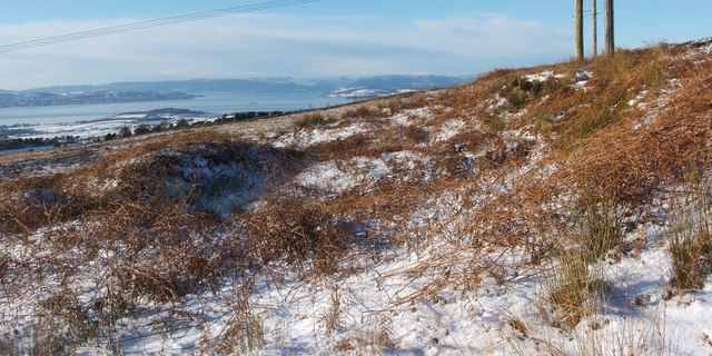
The particular pit shown here lies immediately to the east of a footpath that leads north. It is also shown, viewed in the opposite direction, in NS3779 : Old quarry pit near Carman Hill.
The background of the present picture shows the Firth of Clyde, with Ardmore Point jutting out from the near shore, to the left of centre.
To the north of Carman Hill, a previously unreported line of quarry pits extends from NS36927980 to NS37227976, following some rock outcrops (on which, see below). A single much larger pit at NS36787981 is probably an outlier of the same system. The pits are of uncertain age; if sufficiently ancient, they may have supplied the stones making up a hill-fort just to the south (see Link for views of the fort).
The British Geological Survey's maps of the area show the Gartness Fault here. When present in person, it is clear that there is a discontinuity along the line of the pits, the ground to the north of the fault being higher. See Link (in a Geograph article) for further information.
(Before I had seen those maps, and when I first reported the line of pits to WoSAS, the contact there, while not ruling out my suggestion that they are old quarries, helpfully pointed out that a decoy site was located nearby, at Kipperoch, and that bombs dropped from a moving aircraft would create a line of pits. While I am inclined to favour the idea that the pits along the fault are the result of geology and quarrying, I do agree that bombs account for others nearby.)
At a period later than the one in which these pits were exploited, another quarry Link was created at the foot of Carman Hill. It was originally called the Fairy Knowe Quarry, and later Carman Quarry, and it was a source of red sandstone.
 Map © Crown Copyright")
- Grid Square
- NS3779, 116 images (more nearby 🔍)
- Photographer
- Lairich Rig (more nearby)
- Date Taken
- Saturday, 27 November, 2010 (more nearby)
- Submitted
- Saturday, 11 December, 2010
- Subject Location
-
OSGB36:
 NS 3700 7977 [10m precision]
WGS84: 55:58.9883N 4:36.8538W - Camera Location
-
OSGB36: NS 3702 7977
- View Direction
- WEST (about 270 degrees)