J3874 : Laurelvale, Belfast
taken 13 years ago, 4 km WNW of Dundonald, Co Down, Northern Ireland
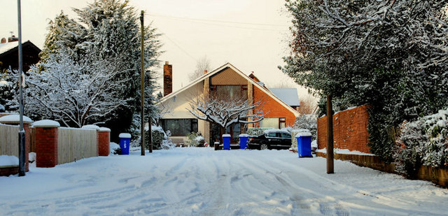
Laurelvale, Belfast
A small cul-de-sac off Sydenham Avenue even the wheelie bins had a deep coating of snow.
East Belfast snow - 17/20 December 2010
There was a very heavy snowfall which started on the previous evening and a further snowfall during the afternoon of 17 December. This is a series of photographs taken in and around parts of east Belfast on 17/20 December 2010.
![Creative Commons Licence [Some Rights Reserved]](https://s1.geograph.org.uk/img/somerights20.gif)
|
· Find out How to reuse this image ·
Share:
|
|||||
| Start a discussion on J3874 | Suggest an update to this image | Contact the contributor | |||
Loading map... (JavaScript required)
- Grid Square
- J3874, 163 images (more nearby
 )
)
- Photographer
- Albert Bridge (find more nearby)
- Date Taken
- Friday, 17 December, 2010 (more nearby)
- Submitted
- Friday, 17 December, 2010
- Category
- Street (more nearby)
- Subject Location
-
Irish:
 J 381 747 [100m precision]
WGS84: 54:36.1311N 5:51.8152W - Camera Location
-
Irish: J 381 747
- View Direction
- WEST (about 270 degrees)
Image classification(about):
Geograph
This page has been viewed about 57 times.
View this location:
KML (Google Earth) ·
Google Maps ·
Bing Maps ·
Geograph Coverage Map ·
More Links for this image
·
Bing Maps ·
Geograph Coverage Map ·
More Links for this image