J4973 : Court Street, Newtownards (8)
taken 13 years ago, near to Newtownards, Co Down, Northern Ireland
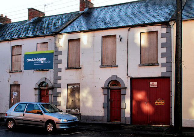
Court Street, Newtownards (8)
Part of the southern side of Court Street which seems likely to vanish to make way for the Castlebawn development. Some of the properties are still occupied. Some have been vacant for many years.
The Castlebawn development, Newtownards
A large-scale, new retail development between the Comber and Portaferry Roads. The building of a ring road around Newtownards was preliminary. The site is visible in this elevated view J4873 : New road, Newtownards (4). The development seems unlikely, in the near future, to proceed in the form originally envisaged. In the meantime part of Newtownards lies blighted.
![Creative Commons Licence [Some Rights Reserved]](https://s1.geograph.org.uk/img/somerights20.gif)
|
· Find out How to reuse this image ·
Share:
|
|||||
| Start a discussion on J4973 | Suggest an update to this image | Contact the contributor | |||
Loading map... (JavaScript required)
- Grid Square
- J4973, 148 images (more nearby
 )
)
- Photographer
- Albert Bridge (find more nearby)
- Date Taken
- Sunday, 9 January, 2011 (more nearby)
- Submitted
- Monday, 10 January, 2011
- Category
- Development site (more nearby)
- Subject Location
-
Irish:
 J 490 739 [100m precision]
WGS84: 54:35.4869N 5:41.6832W - Camera Location
-
Irish: J 490 739
- View Direction
- SOUTH (about 180 degrees)
Image classification(about):
Supplemental image
This page has been viewed about 88 times.
View this location:
KML (Google Earth) ·
Google Maps ·
Bing Maps ·
Geograph Coverage Map ·
More Links for this image
·
Bing Maps ·
Geograph Coverage Map ·
More Links for this image