2011
SP1793 : Public footpath signs, near Curdworth
taken 13 years ago, near to Curdworth, Warwickshire, England
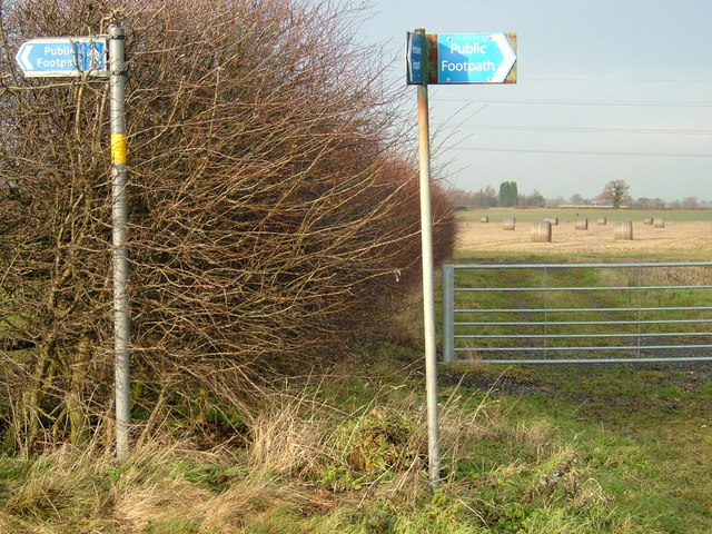
Public footpath signs, near Curdworth
Providing directions to:(1) left (west) towards Wiggins Hill Cottages, Wiggins Hill Road, (2) straight on (north) through metal gate follow hedge then left (west) another route to Wiggins Hill Cottages, (3) right (east) Wishaw Lane, & (4) back (south) to Broad Balk Bridge and A4097 Kingsbury Road, near Curdworth.
 Map © Crown Copyright")
TIP: Click the map for more Large scale mapping
- Grid Square
- SP1793, 54 images (more nearby 🔍)
- Photographer
- David Godfrey (more nearby)
- Date Taken
- Tuesday, 4 January, 2011 (more nearby)
- Submitted
- Friday, 14 January, 2011
- Subject Location
-
OSGB36:
 SP 171 933 [100m precision]
WGS84: 52:32.2809N 1:44.9502W - Camera Location
-
OSGB36: SP 171 933
- View Direction
- NORTH (about 0 degrees)