O0020 : Trig point at summit of Cupidstown Hill
taken 27 years ago, near to Kilteel, Co Kildare, Ireland
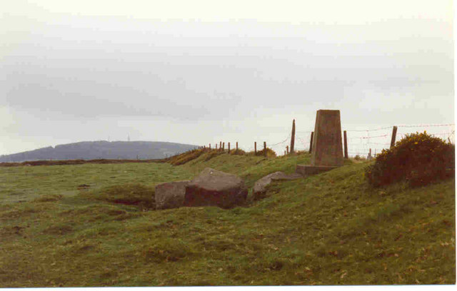
Trig point at summit of Cupidstown Hill
This is the highest point in County Kildare taken in 1997. Most of the hill was planted with coniferous trees in the late 90's. Might be a jungle by now.
![Creative Commons Licence [Some Rights Reserved]](https://s1.geograph.org.uk/img/somerights20.gif)
|
· Find out How to reuse this image ·
Share:
|
|||||
| Start a discussion on O0020 | Suggest an update to this image | Contact the contributor | |||
Loading map... (JavaScript required)
- Grid Square
- O0020, 2 images (more nearby
 )
)
- Photographer
- Bill Griffiths (find more nearby)
- Date Taken
- Friday, 3 October, 1997 (more nearby)
- Submitted
- Tuesday, 22 August, 2006
- Category
- Summit (more nearby)
- Subject Location
-
Irish:
 O 006 207 [100m precision]
WGS84: 53:13.6463N 6:29.6634W
This page has been viewed about 454 times.
View this location:
KML (Google Earth) ·
Google Maps ·
Bing Maps ·
Geograph Coverage Map ·
More Links for this image
·
Bing Maps ·
Geograph Coverage Map ·
More Links for this image