J4569 : Development site, Comber (5)
taken 13 years ago, near to Comber, Co Down, Northern Ireland
Development site, Comber (5)
See J4569 : Development site, Comber (3). The property remains as seen, four months ago, in the previous photograph.
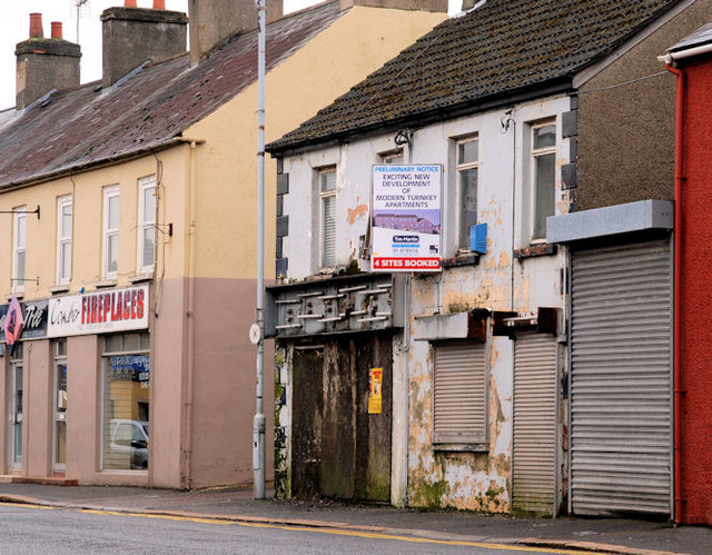
Nos 62-64A Castle Street, Comber
Derelict properties described by the agents as The site has full planning permission under application X/2007/0821/F for the construction of 7 apartments. The photographs submitted by me appear as a matter of geographical and historical record only. I have no connection with any of the parties involved in the development.
![Creative Commons Licence [Some Rights Reserved]](https://s1.geograph.org.uk/img/somerights20.gif)
|
· Find out How to reuse this image ·
Share:
|
|||||
| Start a discussion on J4569 | Suggest an update to this image | Contact the contributor | |||
Loading map... (JavaScript required)
- Grid Square
- J4569, 201 images (more nearby
 )
)
- Photographer
- Albert Bridge (find more nearby)
- Date Taken
- Monday, 14 February, 2011 (more nearby)
- Submitted
- Tuesday, 15 February, 2011
- Category
- Development site (more nearby)
- Subject Location
-
Irish:
 J 457 693 [100m precision]
WGS84: 54:33.0838N 5:44.9073W - Camera Location
-
Irish: J 457 693
- View Direction
- Southeast (about 135 degrees)
Image classification(about):
Geograph
This page has been viewed about 44 times.
View this location:
KML (Google Earth) ·
Google Maps ·
Bing Maps ·
Geograph Coverage Map ·
More Links for this image
·
Bing Maps ·
Geograph Coverage Map ·
More Links for this image