2006
SS7898 : The remains of 'Parson's Folly Tramroad'
taken 18 years ago, near to Tonna, Neath Port Talbot/Castell-Nedd Port Talbot, Wales
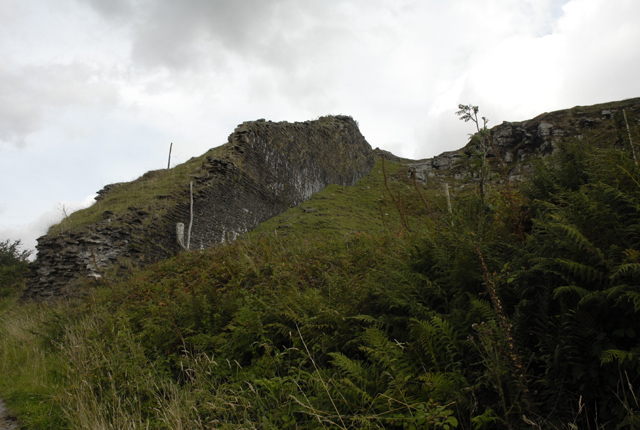
The remains of 'Parson's Folly Tramroad'
Part of the route of the 'Glyncorrwg Mineral Railway' later to be known as 'Parson's Folly Tramroad'. Constructed between 1839 and 1843 to link the collieries near Glyncorrwg in the Afan Valley with the Neath Canal at Aberdulais. The line was so costly to construct that it eventually bankrupted the owner Robert Parsons.
 Map © Crown Copyright")
TIP: Click the map for more Large scale mapping
- Grid Square
- SS7898, 29 images (more nearby 🔍)
- Photographer
- Cedwyn Davies (more nearby)
- Date Taken
- Monday, 28 August, 2006 (more nearby)
- Submitted
- Monday, 28 August, 2006
- Subject Location
-
OSGB36:
 SS 786 985 [100m precision]
WGS84: 51:40.3268N 3:45.4194W - Camera Location
-
OSGB36: SS 786 985
- View Direction
- Southeast (about 135 degrees)