2011
SU2899 : Vee shaped defence
taken 13 years ago, near to Radcot, Oxfordshire, England
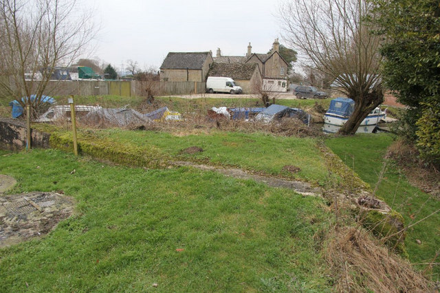
Vee shaped defence
A view of the second defence position at Radcot which is V shaped. It would have been interesting to know its use as it is nothing like the other one a little up the road.
 Map © Crown Copyright")
TIP: Click the map for more Large scale mapping
- Grid Square
- SU2899, 115 images (more nearby 🔍)
- Photographer
- Bill Nicholls (more nearby)
- Date Taken
- Saturday, 29 January, 2011 (more nearby)
- Submitted
- Wednesday, 2 March, 2011
- Subject Location
-
OSGB36:
 SU 286 996 [100m precision]
WGS84: 51:41.6654N 1:35.2051W - Camera Location
-
OSGB36: SU 286 996
- View Direction
- West-southwest (about 247 degrees)