J1246 : Former Cowdy's mill, Banbridge (2011-4)
taken 13 years ago, near to Banbridge, Co Down, Northern Ireland
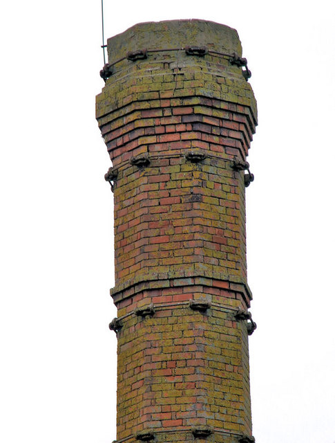
Former Cowdy's mill, Banbridge (2011-4)
The top of the chimney, seen from the other side of the Bann, not on the at risk register but perhaps it should be. The strange colour is partly todays poor light and partly the moss covering the red brickwork.
Former Cowdy's mill, Banbridge
A series of photographs showing the remains of the long-closed Cowdys linen factory in Banbridge.
![Creative Commons Licence [Some Rights Reserved]](https://s1.geograph.org.uk/img/somerights20.gif)
|
· Find out How to reuse this image ·
Share:
|
|||||
| Start a discussion on J1246 | Suggest an update to this image | Contact the contributor | |||
Loading map... (JavaScript required)
- Grid Square
- J1246, 169 images (more nearby
 )
)
- Photographer
- Albert Bridge (find more nearby)
- Date Taken
- Friday, 4 March, 2011 (more nearby)
- Submitted
- Friday, 4 March, 2011
- Category
- Chimney (more nearby)
- Subject Location
-
Irish:
 J 1216 4688 [10m precision]
WGS84: 54:21.4960N 6:16.5293W - Camera Location
-
Irish: J 1214 4675
- View Direction
- NORTH (about 0 degrees)
Other Tags
Image classification(about):
Supplemental image
This page has been viewed about 220 times.
View this location:
KML (Google Earth) ·
Google Maps ·
Bing Maps ·
Geograph Coverage Map ·
More Links for this image
·
Bing Maps ·
Geograph Coverage Map ·
More Links for this image