C9216 : Lower Bann navigation at Movanagher
taken 18 years ago, 3 km from Moneydig, Co Londonderry, Northern Ireland
Lower Bann navigation at Movanagher
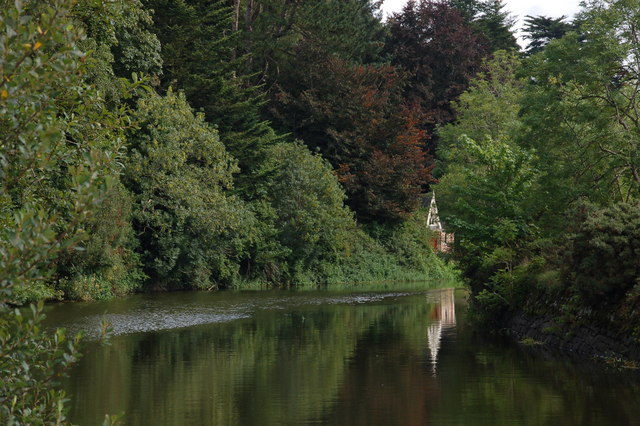
The Lower Bann is navigable from Lough Neagh to the Barmouth near Castlerock. There is a weir and fish farm on the Bann at Movanagher near Kilrea. The river is by-passed by a short stretch of canal. This is the view of the canal looking towards Lough Neagh. The canal is well known to anglers.
![Creative Commons Licence [Some Rights Reserved]](https://s1.geograph.org.uk/img/somerights20.gif)
|
· Find out How to reuse this image ·
Share:
|
|||||
| Start a discussion on C9216 | Suggest an update to this image | Contact the contributor | |||
Loading map... (JavaScript required)
- Grid Square
- C9216, 7 images (more nearby
 )
)
- Photographer
- Albert Bridge (find more nearby)
- Date Taken
- Thursday, 31 August, 2006 (more nearby)
- Submitted
- Thursday, 31 August, 2006
- Category
- Canal (more nearby)
- Subject Location
-
Irish:
 C 92 16 [1000m precision]
WGS84: 54:59.2445N 6:33.3455W - View Direction
- EAST (about 90 degrees)
This page has been viewed about 149 times.
View this location:
KML (Google Earth) ·
Google Maps ·
Bing Maps ·
Geograph Coverage Map ·
More Links for this image
·
Bing Maps ·
Geograph Coverage Map ·
More Links for this image