S3211 : Iske Sullas
taken 13 years ago, 6 km SSW of Rathgormuck, Co Waterford, Ireland
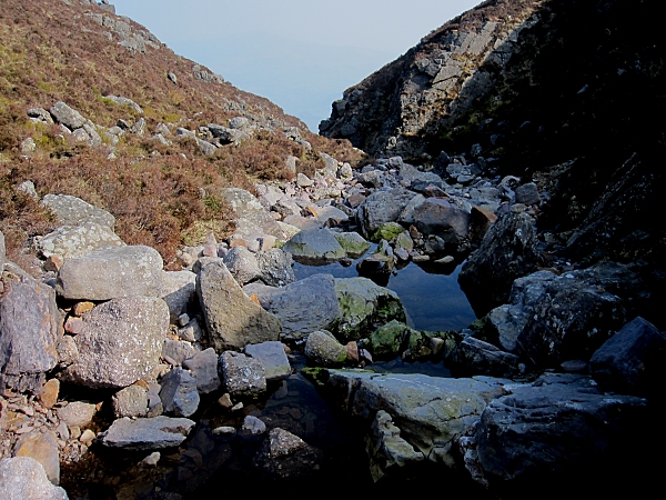
Iske Sullas
The bed of Iske Sullas (Uisce Solais) stream where it plunges into a steep gorge. In normal conditions the stream here creates a waterfall of Bright Water as the name, in rough translation, indicates.
![Creative Commons Licence [Some Rights Reserved]](https://s1.geograph.org.uk/img/somerights20.gif)
|
· Find out How to reuse this image ·
Share:
|
|||||
| Start a discussion on S3211 | Suggest an update to this image | Contact the contributor | |||
Loading map... (JavaScript required)
- Grid Square
- S3211, 10 images (more nearby
 )
)
- Photographer
- kevin higgins (find more nearby)
- Date Taken
- Sunday, 27 March, 2011 (more nearby)
- Submitted
- Monday, 28 March, 2011
- Category
- Stream channel (more nearby)
- Subject Location
-
Irish:
 S 327 116 [100m precision]
WGS84: 52:15.3370N 7:31.2687W - Camera Location
-
Irish: S 326 116
- View Direction
- East-southeast (about 112 degrees)
Image classification(about):
Geograph
This page has been viewed about 88 times.
View this location:
KML (Google Earth) ·
Google Maps ·
Bing Maps ·
Geograph Coverage Map ·
More Links for this image
·
Bing Maps ·
Geograph Coverage Map ·
More Links for this image