2010
TQ5739 : Linden Park Cricket Ground
taken 13 years ago, near to Royal Tunbridge Wells, Kent, England
This is 1 of 5 images, with title Linden Park Cricket Ground in this square
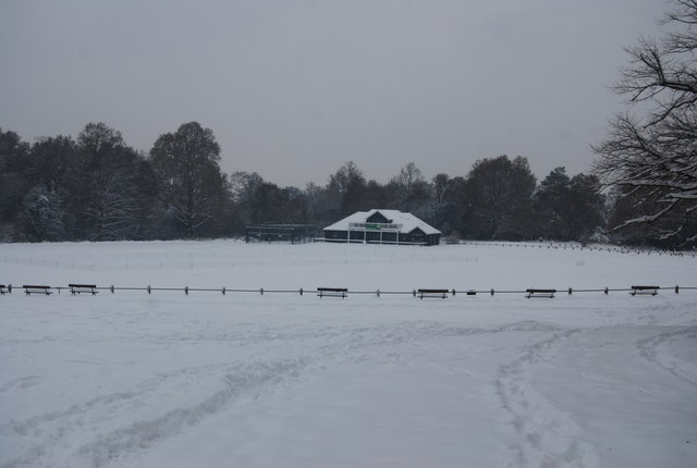
Linden Park Cricket Ground
Although cricket was played on this site informally from the mid-eighteenth century, its status as an official ground dates from 1839 when the newly formed Tunbridge Wells Cricket Club were given permission to use and improve it. It was enlarged in 1859 and 1875. County matches were played here from 1845 to 1880, but they ceased due to the poor condition of the pitch which was regularly trampled by the public and grazing animals. On either side of the pavilion are flowering cherries planted in June 1953 to commemorate Elizabeth II's coronation. Around the cricket ground, and elsewhere on the Common, can be seen a number of cast iron 'hawthorn' benches dating from the 1860s and restored in the early 1990s subsequently, many replicas of the originals have also been made and installed.
Tunbridge Wells Common :: TQ5839
Tunbridge Wells Common is a 104 hectare open space close to the centre of town. Comprising mixed oak woodland and open areas. Originally a common where animals grazed, but trees have grown as grazing declined. Underlain by Tunbridge Wells Sandstone (Lower Cretaceous), which outcrops in several places across the common. Owned by the Borough Council but looked after by the Tunbridge Wells Common Conservators Link
.
 Map © Crown Copyright")
TIP: Click the map for more Large scale mapping
- Grid Square
- TQ5739, 845 images (more nearby 🔍)
- Photographer
- N Chadwick (more nearby)
- Date Taken
- Thursday, 2 December, 2010 (more nearby)
- Submitted
- Wednesday, 20 April, 2011
- Subject Location
-
OSGB36:
 TQ 577 390 [100m precision]
WGS84: 51:7.7358N 0:15.1491E - Camera Location
-
OSGB36: TQ 577 391
- View Direction
- South-southwest (about 202 degrees)