2011
TL7789 : Weeting Castle
taken 13 years ago, near to Weeting, Norfolk, England
This is 1 of 13 images, with title Weeting Castle in this square
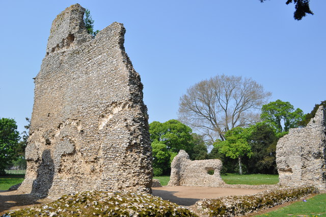
Weeting Castle
Weeting Castle is a 12th-century ruin with a three-story-high tower in Weeting, near Brandon, Norfolk. Despite the name, it is not a castle but actually a fortified manor house. It has a large open hall and an attached two-storey chamber block. There's a domed brick ice-house on the northwest corner of the moat and a small car park next to the church. The moat was added in the 14th century. The place is thought to have been abandoned in 1390. The manor was built on a 10th C settlement. It is now owned by English Heritage. Entry is free and the location is open all year for visitors.
 Map © Crown Copyright")
TIP: Click the map for more Large scale mapping
- Grid Square
- TL7789, 125 images (more nearby 🔍)
- Photographer
- Ashley Dace (more nearby)
- Date Taken
- Monday, 25 April, 2011 (more nearby)
- Submitted
- Monday, 25 April, 2011
- Subject Location
-
OSGB36:
 TL 778 891 [100m precision]
WGS84: 52:28.2737N 0:36.9914E - Camera Location
-
OSGB36: TL 778 890
- View Direction
- North-northwest (about 337 degrees)