J5079 : Wind turbine, Bangor (1)
taken 13 years ago, near to Conlig, Co Down, Northern Ireland
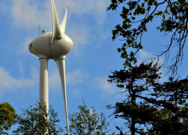
Wind turbine, Bangor (1)
The operational wind turbine (previously seen in J5079 : Wind turbine, Bangor from a different viewpoint) rising above the trees of Balloo Wood J5079 : Balloo Wood, Bangor (2). According to the Councils website The height of the turbine to the hub is 55m. The blades are 24m long. The total weight of the turbine is 98 tonnes. Sensors on the turbine detect wind direction/speed enabling the hub to rotate (yaw) to catch the wind. Depending on wind speeds, the blades will rotate between 3 and 32 revolutions per minute. The turbine will turn between 8 - 55 mph wind speeds. At higher wind speeds, the blades are programmed to 'feather which prevents them catching the wind and the turbine stops for safety reasons.
Continue to J5079 : Wind turbine, Bangor (2).
Continue to J5079 : Wind turbine, Bangor (2).
Balloo Wood, Bangor
A small wood, in what was once the grounds of the 18th century Balloo House (now vanished), in the midst of a large commercial area to the south of the ring road. Managed by the Ulster Wildlife Trust, it has ponds and reed beds as well as deciduous trees. The municipal wind turbine is at the south eastern end.
Wind turbines, Northern Ireland
A collection of photographs showing a few of the many wind turbines (of all sizes) in Northern Ireland.
All photographs submitted by me appear as a neutral matter of record only. I have no involvement with promoting or objecting to wind power. I have no professional or technical knowledge.
![Creative Commons Licence [Some Rights Reserved]](https://s1.geograph.org.uk/img/somerights20.gif)
|
· Find out How to reuse this image ·
Share:
|
|||||
| Start a discussion on J5079 | Suggest an update to this image | Contact the contributor | |||
Loading map... (JavaScript required)
- Grid Square
- J5079, 29 images (more nearby
 )
)
- Photographer
- Albert Bridge (find more nearby)
- Date Taken
- Tuesday, 3 May, 2011 (more nearby)
- Submitted
- Tuesday, 3 May, 2011
- Geographical Context
- Subject Location
-
Irish:
 J 508 794 [100m precision]
WGS84: 54:38.4122N 5:39.8817W - Camera Location
-
Irish: J 507 794
- View Direction
- East-southeast (about 112 degrees)
Other Tags
Image classification(about):
Supplemental image
This page has been viewed about 222 times.
View this location:
KML (Google Earth) ·
Google Maps ·
Bing Maps ·
Geograph Coverage Map ·
More Links for this image
·
Bing Maps ·
Geograph Coverage Map ·
More Links for this image