2011
SE4326 : Wetland
taken 13 years ago, near to Castleford, Wakefield, England
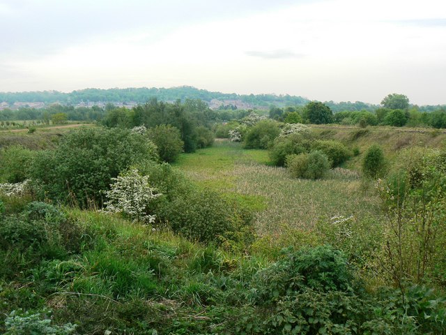
Wetland
The northern end of this pond is overgrown with reeds. It lays between the reclaimed colliery land from Wheldale Colliery, on the left of this view, and a disused railway line on the right of this view.
 Map © Crown Copyright")
TIP: Click the map for more Large scale mapping
- Grid Square
- SE4326, 176 images (more nearby 🔍)
- Photographer
- bernard bradley (more nearby)
- Date Taken
- Friday, 6 May, 2011 (more nearby)
- Submitted
- Friday, 6 May, 2011
- Subject Location
-
OSGB36:
 SE 438 266 [100m precision]
WGS84: 53:44.0373N 1:20.2150W - Camera Location
-
OSGB36: SE 438 266
- View Direction
- South-southeast (about 157 degrees)