2011
TR3260 : Watling Street at Richborough
taken 13 years ago, near to Great Stonar, Kent, England
Watling Street at Richborough
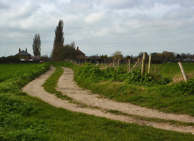
Richborough was the Roman "Gateway to Britain" and the starting point of Watling Street, leading from Richborough, or Rutupiae, to Canterbury and on to London. The start of the road was marked by an enormous archway in the centre of Richborough Fort. Only the foundations of the archway still exist, but the route of Watling Street, seen here just outside the fort, is still to be seen in the form of this farm track.
 Map © Crown Copyright")
TIP: Click the map for more Large scale mapping
- Grid Square
- TR3260, 166 images (more nearby 🔍)
- Photographer
- Eileen Henderson (more nearby)
- Date Taken
- Friday, 1 April, 2011 (more nearby)
- Submitted
- Sunday, 8 May, 2011
- Subject Location
-
OSGB36:
 TR 322 602 [100m precision]
WGS84: 51:17.6219N 1:19.8246E - Camera Location
-
OSGB36: TR 323 602
- View Direction
- West-northwest (about 292 degrees)