2011
SW7215 : Wall - Local Serpentine Stone used for building
taken 13 years ago, near to Ruan Minor, Cornwall, England
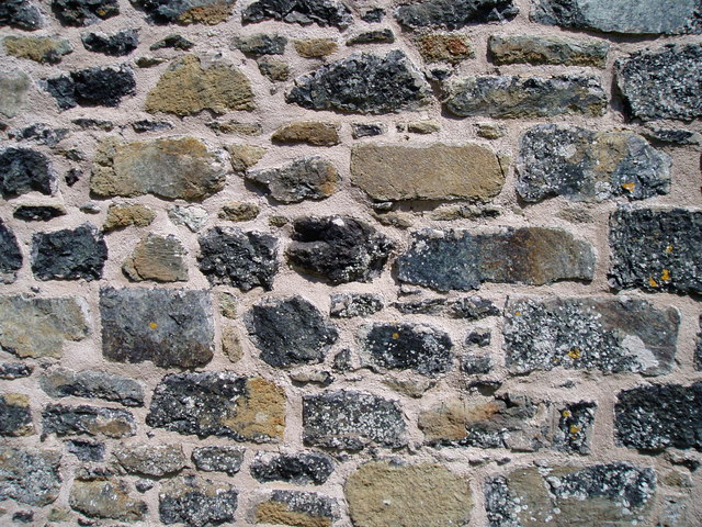
Wall - Local Serpentine Stone used for building
This photo shows the great variety of serpentine rocks used in the building of what was the home of the manager of the Lizard Serpentine Company's stone works at Carleon Cove, Poltesco. SW7215 : Owner's House for Serpentine Quarries and Factory
The many of the rocks in the Lizard area are special, but not unique. They have come from the mantle deep below the earth's surface. Some 350 million years ago a mass of molten rock burst up from within the earth's mantle and picked up all sorts of different rock types on its passage to the surface of the earth. Then later, due to movement of the tectonic plates, this same rock was subjected to even more heat and pressure resulting in a rock we see today which varies in colour, texture and patterning. This rock, called 'serpentine' can now be seen in outcrops all around the Lizard. Some of the rock is suitable for turning on a lathe or for being sculptured into delicate ornaments the best know being a lighthouse shaped ornament. Such ornaments sold mostly as tourist souvenirs are made locally by a handful of craftsmen. There are only few craftsmen left from what years ago was a flourishing serpentine industry of the Victorian period.
The stone not suitable for decorative work was used in ordinary buildings as shown in this photo. SW7216 : Lighthouse ornament created from serpentine rock SW7215 : Water-wheel pit (remains)
 Map © Crown Copyright")
TIP: Click the map for more Large scale mapping
- Grid Square
- SW7215, 65 images (more nearby 🔍)
- Photographer
- Colin Vosper (more nearby)
- Date Taken
- Saturday, 21 May, 2011 (more nearby)
- Submitted
- Saturday, 28 May, 2011
- Subject Location
-
OSGB36:
 SW 727 156 [100m precision]
WGS84: 49:59.8505N 5:10.3449W - Camera Location
-
OSGB36: SW 727 156
- View Direction
- North-northeast (about 22 degrees)