J2867 : Aberdelghy golf course, Derriaghy
taken 13 years ago, near to Ballyskeagh, Co Down, Northern Ireland
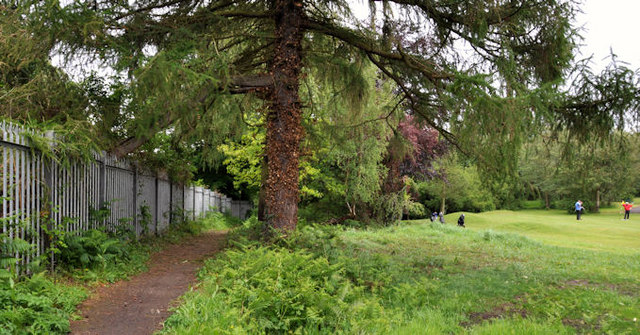
Aberdelghy golf course, Derriaghy
Aberdelghy golf course J2766 : Aberdelghy golf course, Lambeg (1) stretches from Lambeg to Derriaghy. This is the northern end near Conway Lane.
Aberdelghy Wood, Lambeg/Derriaghy :: J2766
Aberdelghy Wood is the remains of the estate of the former Aberdelghy House a 19th century Lagan valley linen house (now demolished). The wood and paths are between the railway and the 9-hole Aberdelghy golf course. It runs from Bells Lane, Lambeg (convenient car park) to Conway Lane off the River Road at Derriaghy.
![Creative Commons Licence [Some Rights Reserved]](https://s1.geograph.org.uk/img/somerights20.gif)
|
· Find out How to reuse this image ·
Share:
|
|||||
| Start a discussion on J2867 | Suggest an update to this image | Contact the contributor | |||
Loading map... (JavaScript required)
- Grid Square
- J2867, 79 images (more nearby
 )
)
- Photographer
- Albert Bridge (find more nearby)
- Date Taken
- Saturday, 28 May, 2011 (more nearby)
- Submitted
- Saturday, 28 May, 2011
- Geographical Context
- Subject Location
-
Irish:
 J 282 675 [100m precision]
WGS84: 54:32.3765N 6:1.1719W - Camera Location
-
Irish: J 281 674
- View Direction
- Northeast (about 45 degrees)
Other Tags
Image classification(about):
Geograph
This page has been viewed about 120 times.
View this location:
KML (Google Earth) ·
Google Maps ·
Bing Maps ·
Geograph Coverage Map ·
More Links for this image
·
Bing Maps ·
Geograph Coverage Map ·
More Links for this image